Rain is on the way then cooler temps, but the weekend looks nice so far

Published 7:38 pm Monday, February 17, 2020
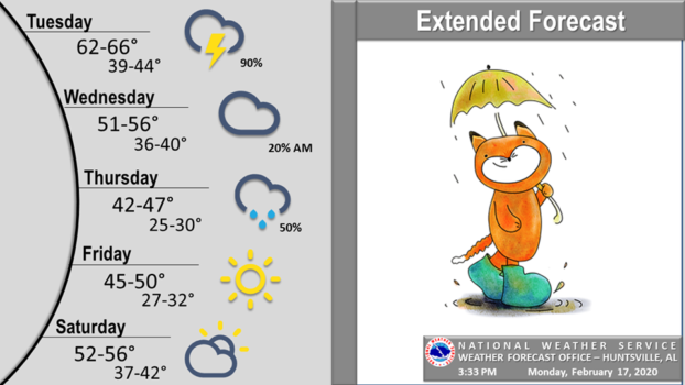
The US National Service in Huntsville said increasing clouds are expected ahead of the rain that will move in tonight. Showers and a few thunderstorms will continue into Tuesday evening as a cold front gradually moves eastward across the region.
Showers will come to an end by Wednesday morning, giving us a break from the rain on Wednesday. However, a second wave of moisture and rainfall moves northeast across the area on Thursday.
Cooler and drier air will then spread into the area late Thursday into Friday as a strong dome of high pressure settles into the Southeast states. Temperatures will be increasing again, though, as we go into next weekend.

